TOWNSHIP OF WASHINGTON—A team of college student interns—part of the PSE&G Sustainability Green Teams Program—recommends three options to help drain or contain stormwater that increasingly contributes to floods in the Township of Washington.
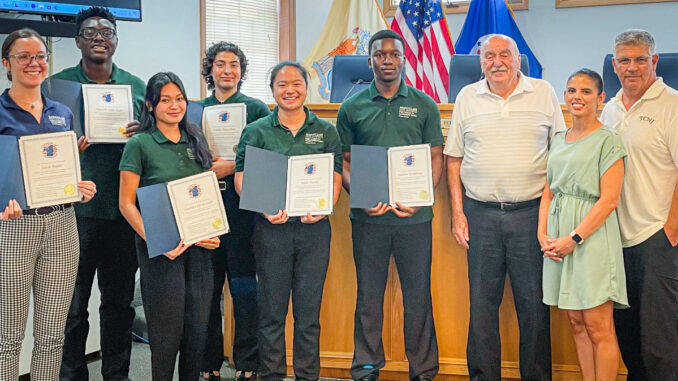
At a 36-minute special meeting on Tuesday, July 30 at noon, the group presented its findings to council vice president Steven Cascio, councilman Tom Sears, and councilwoman Daisy Velez. They provided a detailed account of the Musquapsink Brook watershed’s problems and possible solutions.
Mayor Peter Calamari, council president Michael DeSena, councilor Michael Ullman, and administrator Mark DiCarlo were absent. Clerk Susan Witkowski attended, as did, via Zoom, town attorney Siobhan Spillane Bailey.
Working on the flood mitigation project were Cayla Capistrano, Rutgers University; Terrell Osei-Kyei, The College of New Jersey; MeiLi Han, Hofstra University; Emily Pazuello, Montclair State University; and Vinlaw Mudehwe, Case Western Reserve University. Project manager was Sara Reper, of Montclair State University.

(Reper’s LinkedIn notes she most recently worked on an intern team for the Port Authority of New York and New Jersey, collecting water asset data to improve emergency response capabilities and creating an energy consumption calculator that accounts for four of Port Authority’s administrative buildings.)
The 2024 final presentations event for the project’s Ninth Annual Green Teams Program took place on Wednesday, Aug. 7 at Montclair State University’s Alexander Kasser Theater and via Zoom. “Fifty undergraduate students from diverse majors and 31 institutions of higher learning shared inclusive practices to address today’s sustainability challenges.”
The focus of this summer’s projects, in collaboration with 10 hosting organizations and a partnership with Kansas State University, included agricultural technology, flood mitigation, food security, electric vehicles, artificial vs. grass turf, carbon emissions, Net Zero, ecosystem services, sustainability strategies, social impact, and community involvement.
Residents have power to help
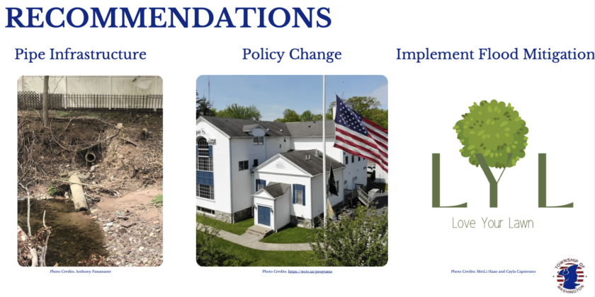
Here at home, the team recommended three flood-mitigation options: clearing storm drains, increasing buffer zones around the brook, and converting lawns into stormwater retention areas such as rain gardens with native plants and trees.
Though costs for all three programs were estimated at $91,885,695, approximately $91,461,154 of that was for a proposed “Love Your Lawn” program to re-landscape home lawns to conserve water.
The students also created a digital “Love Your Lawn” brochure.
The two other recommended options, Adopt-A-Drain, where residents may voluntarily adopt a drain and keep it clean from debris such as leaves and litter, and increasing private buffer areas around the brook, were estimated at $203,652 and $220,889, respectively.
It was not explained how residents living near Musquapsink Brook could increase or enhance buffer zones near the brook, or the costs for such improvements on private land.
‘Information I wasn’t aware of…’
Cascio thanked the students and called their report “a wonderful presentation. I think as a council that we can implement some of those things. A lot of new information I wasn’t aware of,” he added. “And I appreciate always learning about those things.”
All the students were presented with certificates of appreciation for their work. Velez thanked Sears especially for working with the students on their project. Sears thanked the students for their efforts, noting they “did a lot of good work on this.”
“I know we can implement some of this stuff. The nice thing about it, I think, is a lot of this is not cost-prohibitive to do,” Cascio said.
The three councilors at the special meeting, Cascio, Sears, and Velez, did not specify any new flood-mitigation efforts they would undertake following the presentation.
Findings and analysis
The students’ report provided results from a public survey they conducted, identifying potential sources of flooding, land use percentages, runoff contributed from outside the local watershed, runoff calculations, and options for flood mitigation, including maximizing water drainage and maximizing water retention.
The students offered commentary during a computer presentation, which was recorded by WCTV for later broadcast. An archived copy of the meeting’s YouTube video can be accessed on the township website.
The students, all interns in the PSEG Institute For Sustainability Green Teams Program, worked in concert with Sears and Calamari. The program is a partnership with Montclair State University.
Goals and methodology
The survey, study, and data analysis undertaken by the student Green Team had three goals: improve local stormwater management, create an effective flood mitigation plan, and increase community engagement.
The students conducted a watershed hydrology assessment, data collection and mapping, created a flood mitigation plan, and conducted a survey.
‘Significant erosion’
The students found “significant erosion” around areas of Musquapsink Brook, including areas that frequently flood. One student reported that along certain portions of the brook, property boundaries had been eroded and pushed back due to severe erosion.
They visited about 11 sites along the brook where severe streambank erosion existed.
A public survey, conducted via social media and in-person at The Fresh Grocer, was taken to help quantify local flood damage and gather community input. “It was clear to us that flooding was severe in terms of flooding damages,” said one student.
Of 187 survey responders, the majority said they suffered between $1,000 to $5,000 in property damage during the prior five years. The next two largest groups experienced between $5,001 to $15,000 in damages, and the next had approximately $1,000 or less in damages.
A minority of residents surveyed said they suffered over $15,000 in flood damages, with only a small number suffering between $30,000 to $100,000 or more in total flood damages. The number of residents suffering larger damage amounts declined as the amounts increased.
Drilling down: flood areas
The survey also showed most residents experienced flooding damage in the basement, backyard, and front yard as the top three impact areas. Other areas flooded in descending order were the garage, side yard, first floor, bathroom, and second floor.
Another student said most people believed flooding originated from the roads, lake, and Musquapsink Brook. She said the students wanted to know the sources of flooding “so they could tackle the problem at its root.”
The students noted their analysis relied on watershed data and mapping from the U.S. Geological Survey, NJ Department of Environmental Protection, U.S. Department of Agriculture, and Boswell Engineering.
The Musquapsink Brook watershed land use broke out to 16% mostly forest, wetlands, agriculture, or water-covered, while 84% of land use was categorized as urban or barren land.
The report noted “urban land” was composed of land with asphalt, concrete buildings, or artificial turf fields, and “barren lands” constituted areas where plant growth is minimal or sparse, such as dry dirt or previously developed, paved, and concrete areas.
They identified four points where runoff may be “compounded” because those areas drain land outside the watershed, including Jacob Road, near Horizon Court, Katharina Place, and Lafayette Avenue, where runoff from outside the watershed enters and could aggravate in-town flooding.
The students said that approximately 25% of the total watershed area was covered by an “impervious surface” where water cannot infiltrate the soil or ground. They also reported that it was unlikely that Washington Lake (i.e., Schlegel Lake) could serve a flood mitigation role.
They noted the lake would be required to discharge 11.51 feet of depth to absorb one inch of rainfall during a storm, an unlikely scenario.
Another flooding risk analysis showed five “high risk areas” around town, including Barry Drive, Amherst Drive, Adams Place, Beech Street, and Cosman Street.
Green mitigation options
Their survey also found among green mitigation options, residents favored reforestation (75%) and rain gardens (68%) as the top two favored options. Other green options were bioswales (67%), rain barrels (57%), and green roofs (55%) to reduce runoff. The options were not explained, nor costs estimated.
The students’ “Love Your Lawn” program promoted the use of native plants and trees in lieu of grass to help reduce and retain runoff on site.
Cost and grant funding
By implementing an Adopt-A-Drain program, enhanced brook buffer zone, and Love Your Lawn programs, the student team estimated that nearly 30 million cubic feet of runoff water could be contained/drained in the township. They estimated a total cost of $91,885,695 to implement all three programs township-wide.
However, to subsidize the cost, they suggested applying for grant funds from the federal Inflation Reduction Act (IRA) Community Change Grants, Environmental and Climate Justice, administered by the U.S. EPA, which, they said, had a $2 billion average grant payout.
They said implementing these three recommended solutions would likely cut post-storm runoff from a four-inch storm to about 1.76 inches of rain, or a 56% runoff reduction.
Ongoing and future efforts
In 2023, the township authorized a drone study of eight sections of the Musquapsink Brook watershed, conducted by Boswell Engineering.
Currently, the council has appropriated $750,000 for emergency repairs to eroded stream banks near two sanitary manholes, identified as possible sources of fecal contamination to the stream if not repaired immediately.
Officials anticipate work commencing on the emergency stream bank stabilization sometime this fall.
Also, three contiguous towns—Westwood, River Vale, and Hillsdale—have conducted similar stream drone studies mapping fallen trees, stream bank erosion, and sediment shoals.
Their reports are expected to be publicly released later this summer or early fall and form the basis for future multi-town grant proposals to improve stream flow, reduce flooding, and enhance water quality.
