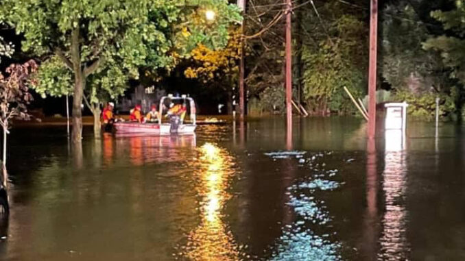
WESTWOOD—The borough’s new land use measure to help reduce flooding impacts by requiring new residential access roads and parking lots to be raised one foot above “base flood elevation” is up for a hearing on Tuesday, Oct. 12 at Borough Hall.
The update was required by the state Department of Environmental Protection.
The ordinance reflects updated state DEP land use and flood damage prevention regulations and follows a summer of occasionally intense tropical storms, thunderstorms and remnants of two tropical depressions, hurricanes Henri and Ida, that saturated the state and caused widespread flooding, stream bank erosion, property damage, and loss of life.
According to Mayor Ray Arroyo, the measure might not reduce all flood impacts but it certainly has its advantages.
“Hopefully, it will limit additional repeated flood losses on new residential construction that might otherwise encroach on the floodplain,” Arroyo told Pascack Press on Oct. 6.
He said that “Westwood, in land-use parlance, is a fully developed community. Our limited open space includes wooded areas adjacent to the Pascack and Musquapsink brooks. NJDEP’s Blue Acres Program provides grant funding for municipalities to purchase existing homes in flood prone areas and restore them to nature.”
He added, “New residential construction in these very same, environmentally sensitive areas would seem both counterintuitive and counterproductive to these restoration efforts.”
According to the proposed ordinance, 21-24, “An access drive (public or private), or parking area serving a new multi-family residence, single family, duplex residence shall be constructed such that the travel surface is at least one foot above the flood hazard area design flood elevation as required by the Flood Hazard Control Act Rules at N.J.A.C. 7:13-12.6 as revised.”
It says, “Deviations from these standards shall be deemed a variance subject to the review and variance procedures contained in this Chapter and the Municipal Land Use Law.”
Arroyo told Pascack Press that certain areas in Hillsdale are prone to repeated flooding, such as areas near the Musquapsink Brook and Hackensack tributaries, where specific residents’ homes get flooded regularly.
According to the ordinance, the flood hazard areas of the Borough of Westwood are subject to periodic inundation, which results in loss of life and property, health and safety hazards, disruption of commerce and governmental services, extraordinary public expenditures for flood protection and relief, and impairment of the tax base, all of which adversely affect the public health, safety, and general welfare.
The measure notes “These flood losses are caused by the cumulative effect of obstructions in areas of special flood hazard which increase flood heights and velocities, and when inadequately anchored, cause damage in other areas.”
It says, “Uses that are inadequately floodproofed, elevated or otherwise protected from flood damage also contribute to the flood loss while adversely affecting the public health, safety, and general welfare.”
Arroyo said the ordinance follows the regulations contained in the Flood Hazard Control Act; “Therefore it adds no new construction costs above what the statute might already generate. It expressly codifies them in the local ordinance to make the public aware of the statewide rules that apply in these situations.”
Arroyo noted the new ordinance, “might dissuade residential overdevelopment in and around flood-prone areas to help safeguard public health and safety.
