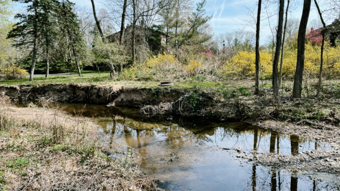
TOWNSHIP OF WASHINGTON—The township’s engineering consultant will present on the Pascack Valley’s first drone study of a major waterway, with an eye to improving water flow and reducing flooding, at the next meeting of the mayor and council, Monday, July 10 at 6:30 p.m.
The report identifies problems and potential solutions to improve conditions in Musquapsink Brook, a major tributary of Pascack Brook that flows through the township.
Further meeting details can be found on the council agenda posted online, usually a few days before, likely by Friday, July 7 at the latest. It was not clear if a link to the full study would be posted prior to July 10, or whether report copies would be available.
“Musquapsink Brook Condition Assessment” examines the condition of Musquapsink Brook, a Category One waterway that is a tributary to the Pascack Brook, and eventually leads into Oradell Reservoir, a drinking water source for 800,000 Bergen, Passaic, and Hudson county residents.
Other towns in Pascack Valley are considering undertaking drone studies, and the Pascack Valley Mayors Association, representing the eight Pascack Valley towns plus Oradell and Old Tappan, have requested financial assistance from Veolia for a comprehensive drainage basin drone study to help reduce flooding, reduce streambank erosion, and improve water flow and water quality. (See “Council floats on drone study of brook,” Michael Olohan, March 27, 2023, Pascack Press.)
The study, produced by Boswell Engineering in February, was not publicly discussed by mayor or council following its completion, despite Pascack Press requests for comment. We received a copy initially when we questioned Boswell Engineering invoices on the Musquapsink Brook.
Our report on the study can be found at PascackPress.com, “Drone study highlights brook obstructions, recommends ways to improve flow, stem flooding.”
Without elaboration, the report speaks to two “unnamed tributaries” to the brook, but not the one that runs behind the previously proposed Four Seasons Marketplace shopping plaza at Pascack Road and Washington Avenue.
That waterway was determined to be not regulated by a Boswell Engineering review that determined it drained an area of 48.832 acres, and not 50 acres required under the state’s Flood Hazard Area Act rules.
The township website notes, “The Musquapsink Brook that flows through our town has been a constant concern for many years, and the issues it causes are not unique to our town as many surrounding municipalities face similar challenges. Unfortunately, there are no quick, easy, or inexpensive solutions to the problems that arise from the brook.”
It says, “One of the main challenges we face is the lack of available grant money to combat some of the concerns. Our grant writer (GLD Associates, Summit) as well as other town’s grant writers are always on the lookout for potential funding sources, but currently, there are no grants available.”
It adds, “Despite these challenges, our town has taken a proactive approach by commissioning a drone to survey the brook. This is a significant step, and we are proud to be the first municipality in the Pascack Valley to take this initiative and procure a study of the waterways. We did so in an effort to provide a better view of the extent of the issues and have the footage ready and available should grants become available.”
In April, we reported that the study listed nearly 100 obstructions along the Musquapsink Brook’s 3.6-mile length in the township.
Boswell Engineering lists 45 downed trees and 33 sediment shoals as obstructions, 14 areas where stream banks require stabilizing and five potential “critical sanitary issues” where the stream runs near a sanitary sewer line, and offers recommendations to help improve stream flow and minimize local flooding.
The report cites one issue that requires “utmost priority” and other “critical sanitary issues” where the brook either runs near or around a sanitary sewer structure or sewer line that could potentially expose human and household wastes to the stream flow or allow stream flow to enter a sanitary sewer line.
No costs were provided for the needed upgrades in the report, although the report details what state Department of Environmental Protection permits are needed for all the recommended work, including tree removals, shoal remediation, and fixing the streambank and sanitary sewer issues.
The cost for the Musquapsink Brook drone study also could not be immediately determined.
We asked mayor Peter Calamari and council president Desserie Morgan to comment on the report in April. Calamari did not respond then; Morgan said “no plans have been discussed.”
“Musquapsink Brook Condition Assessment” notes, “The Township may want to explore obtaining grant monies from the (Natural Resources Conservation Service) for the stream stabilization in the area of the sanitary sewer line bank erosion.”
It says, “By removing the obstruction within the watercourse this will help to alleviate nuisance flooding caused by the obstructions by reducing the displacement of floodwaters and increase the available capacity of the waterway.”
And it adds, “It would be in the best interest of the Township to apply for and receive an Individual Permit to stabilize the eroded banks of the Musquapsink Brook to reduce the amount of sediment being displaced and deposited within the channel.”
