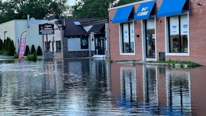
HILLSDALE—The Borough Council on May 14 approved funding for a drone study of Pascack Brook that will make Hillsdale the fourth Pascack Valley town to undertake such an aerial study, following Washington Township, Westwood, and River Vale.
The vote to okay funding was 4-0, with council president John Escobar and councilwoman Janetta Trochimiuk absent.
Councilors approved $8,500 for the drone study, which will start soon and be conducted by Boswell Engineering.
Washington Township conducted its study in winter 2023, and both Westwood and River Vale conducted studies over the fall/winter months after area trees had shed their leaves, offering clear views of local waterways.
Borough Administrator Michael Ghassali said that Boswell officials had told him though current tree conditions were not “ideal,” the engineering firm could still acquire the stream data necessary by both drone overflights and Boswell employees walking the streams to take photographs, identify problems, and map the stream’s conditions through the borough.
He did not specify a state date for the study. Ghassali said the funds would come from a local stormwater management fund, part of the municipal budget. He said he heard that it takes several months for a final drone study report to be completed following field work.
When it’s completed, Ghassali said the Hillsdale stream data will be combined with stream data from the other three towns as part of a study undertaken by a Stevens Institute of Technology professor who is studying the interaction of rainfall patterns, reservoir levels and flooding.
He said the pressure was on to get Hillsdale’s stream data because the Stevens professor needed to submit a data report including the four towns by this summer.
Last summer, the council discussed doing a drone study of Pascack Brook. However, due to estimated costs that were much higher, they postponed a decision.
Mayor Michael Sheinfield told councilor Justin Fox that the Stevens’ study was being done so that the four towns might get future state or federal funding for regional flood control measures.
Ghassali noted that State Sen. Holly Schepisi (R-39) obtained $200,000 in state funding to undertake the Stevens Institute of Technology study, which was announced with much fanfare last August at a special Westwood meeting.
So far, the recent drone studies in Westwood and River Vale have not been publicly released. It was not immediately clear when results would be available.
The Township of Washington drone study, released in April 2023 after a Pascack Press public records request, detailed eight sections of the Musquapsink Brook as it traversed the township. The study identified 45 downed trees, 33 sediment shoals, and 14 areas with eroded stream banks.
Moreover, the report identified at least two “critical sanitary issues” where the brook either runs near or around an exposed sanitary sewer manhole structure, or sewer line, that could potentially expose human and household wastes to the stream or allow stream flow to enter a sanitary sewer line, notes the report.
At a late April Township Council meeting, officials said Boswell Engineering estimated that repairing the stream banks near the two sanitary sewer manholes could cost nearly $700,000, including $60,000 for Boswell engineering fees.
In April 2023, Pascack Press reported on the township’s study in “Drone study highlights brook obstructions, recommends ways to improve flow, stem flooding.”
The township drone study, dated February 2023, can be found on the town’s website. Articles related to the township drone study can be found at PascackPress.com.
